Bible, History, Archaeology
History,
Archaeology
Home >
Jerusalem
in the time of King Herod I and Jesus
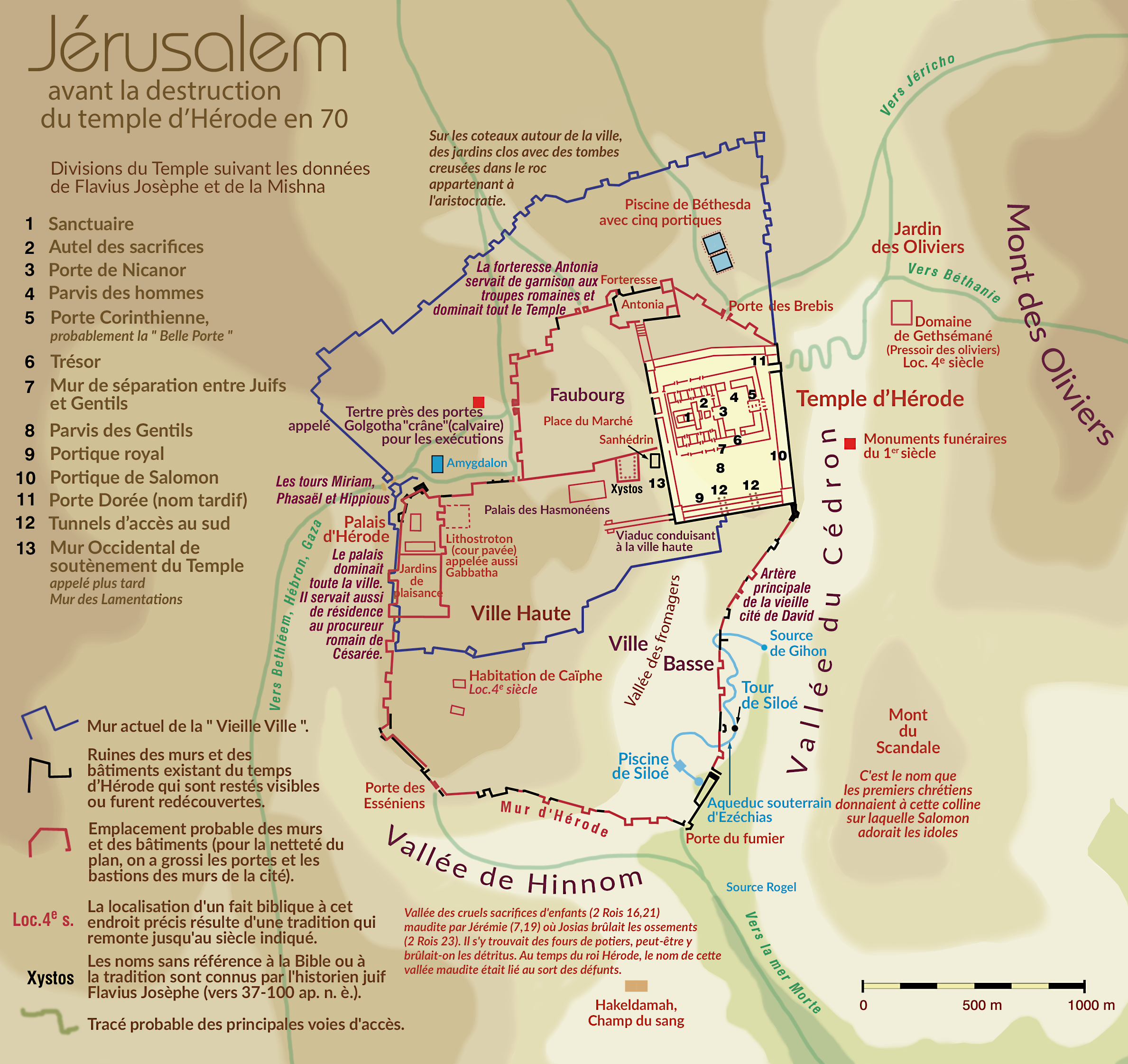
Map of Jerusalem at the time of King Herod I and Jesus of Nazareth
Archaeologists have never doubted the location of ancient Jerusalem. Instead, they have focused on discovering and identifying its walls, gates and holy places. They have encountered difficulties, however, as Jerusalem has been besieged, conquered or partially or totally destroyed more than forty times. Ruins heaped upon ruins, and debris cluttered many valleys. In some places, it has been necessary to dig down to depths of over 12 meters to find the level of the streets on which Jesus walked, and even 10 meters lower to reach those used by the Old Testament characters. It's also worth noting that most parts of Old Jerusalem are now covered by modern buildings or cemeteries, so most of the city cannot be excavated.
To view a map of Jerusalem, click on the image.
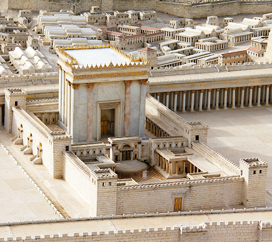
What was the Temple of Jerusalem like?
Historians and archaeologists will soon be able to learn with some precision what the «Second Temple», destroyed by the Romans in 70 A.D., looked like. This possibility has been opened up by the discovery of the remains of the Samaritan temple on Mount Gerizim near Shechem. This temple, as documented by Flavius Joseph in his writings, was built as a faithful reproduction of the Jerusalem Temple.
Recent excavations on Mount Gerizim have uncovered, among other things, the 160-metre-long western wall. A seven-metre-high wall and gigantic, twenty-metre-wide porticoes were also discovered, the like of which has never before been found in Israel. Researchers also came across thirty Hebrew and Greek inscriptions relating to the appointment of priests.


