Bible, History, Archaeology
History,
Archaeology
Home > Cartography >
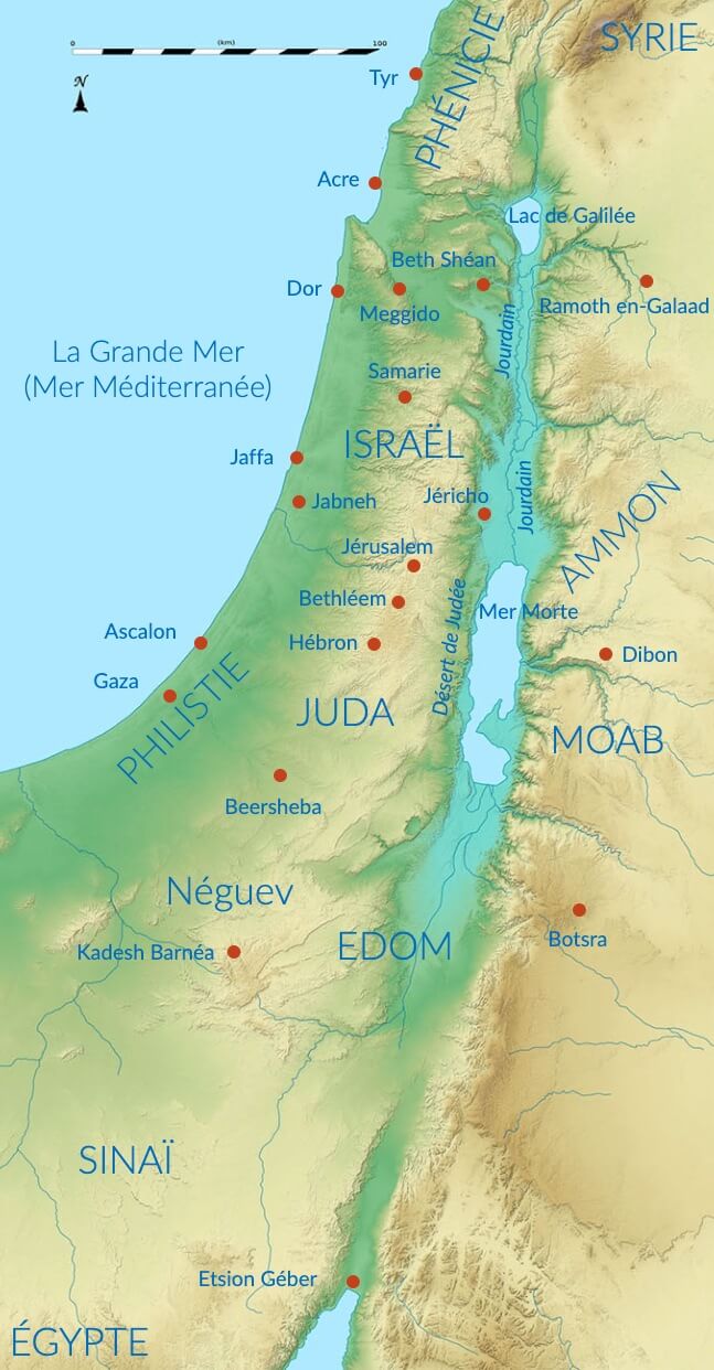
General topography of biblical Israel
The Land of Israel, now called Palestine, borders the southern part of the eastern coast of the Mediterranean Sea.
The physical map can be schematically divided into several north-south bands. The westernmost part, the coastline, is a vast fertile plain.
To the east of this lies a region of arid desert hills known as Judea in the south, Samaria in the center and Galilee in the north. Further east, the topographical profile descends to a natural line whose altitude is below sea level. This is the Levant geological fault, a sort of long fracture in the earth's crust that runs across the continent from Turkey to the Red Sea. This fault is partially occupied to the north by Lake Tiberias, whose level is minus 200 meters, and to the south by the Dead Sea, whose altitude is minus 400 meters. The eastern slope of the Levant Fault is occupied by the immense Jordan Plateau, an almost continuous desert.
Further east, the Tigris and Euphrates rivers flow from their sources in Turkey through Syria to Iraq, irrigating the vast alluvial plain of Mesopotamia.
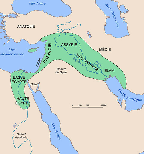
To the south of Israel lies the rocky Sinai peninsula, framed by the two terminal branches of the Red Sea, which separate it to the east from the great Arabia and to the west from the rich Egypt that owed its prosperity to the blessings of the Nile.
This whole area is known as the Fertile Crescent., because, on a grand scale, it evokes an arched oasis surrounded by the vast deserts of Libya, Arabia and Syria.
This is the setting for the most famous of ancient stories, which has left its mark on the cultural and religious foundations of our civilization.